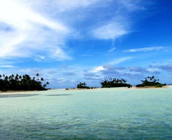
Kiribati is an island nation, which comprises of 33 atolls in toto. With this article, get to explore some fun and interesting facts about Kiribati.
Facts About Kiribati
Kiribati is an island nation, which is located in the central tropical Pacific Ocean, about 4,000 km (about 2,500 mi) to the southwest of Hawaii. The island nation comprises of 33 islands, along with raised coral island. The islands can be divided into three separate groups - Kiribati (including Banaba Island, formerly Ocean Island) Islands, Line Islands and Phoenix Islands. All the islands in Kiribati are low-lying coral ones, with coastal lagoons, with the only exception being Banaba. There are no hills or streams throughout the island nation and the vegetation basically comprises of coconut palms and pandanus trees. According to scientists, a rise in sea levels by 2m is capable of drowning the nation completely. For this reason, the Government of Kiribati requested New Zealand and Australia to make provisions for the people of Kiribati when such a situation takes place. Given below is more information on Kiribati.

Image: KevGuy4101@flickr
Fast Facts
Location: Central tropical Pacific Ocean
Area: 811 km2
Capital: South Tarawa
Population: 101,093 (2011)
Currencies: Kiribati dollar, Australian dollar
Official Languages: English and Kiribati
Calling Code: 686
Independence Day: July 12, 1979
Type Of Government: Parliamentary Republic
Fun & Interesting Facts about Kiribati
- The official name of Kiribati is ‘Republic of Kiribati’.
- The official languages of Kiribati are English and Gilbertese.
- Majority of the people in Kiribati are Roman Catholics and Protestants.
- The main ethnic groups in Kiribati include Micronesian and Tuvaluan minority.
- The currency of Kiribati is Australian dollar.
- The capital of Kiribati is South Tarawa.
- Kiribati follows the system of ‘Presidential Republic’ (single-party state).
- Kiribati gained independence from the United Kingdom, on 12th July 1979.
- The main island groups in Kiribati include the Gilberts Group, the Phoenix Group and the Line Islands Group.
- Kiribati constitutes of 33 islands.
- This island nation is one of the poorest nations in the world. Exports in copra and fish and tourism are the major sources of income for this country.
- The island of Banaba (81 m), one of three large phosphate rock islands in the Pacific, forms the highest point on Kiribati.
- The island of Kiritimati (Christmas Island) boasts of being the largest island in the world, in terms of land area.
- Kiribati Islands were earlier known as the Gilbert Islands, after Thomas Gilbert, a British navigator.
- The Kiribati flag consists of a red and gold frigatebird flying above a golden sun that rises from a blue and white striped ocean. The frigatebird signifies the sea, freedom, power and the Kiribati ethnic dance styles. The sun represents the position of the island nation at the equator. The wavy ocean denotes the Pacific Ocean.
- Situated around the equator, Kiribati was first inhibited by Austronesian-speaking individuals even before the 1st century A.D.
- Kiribati became part of the British Protectorate of the Gilbert and Ellice Islands (Tuvalu), in the year 1892.
- Gilbert and Ellice Islands were made a British colony in 1916.
- Ellice Islands gained independence in 1978 and were renamed as Tuvalu. While, Gilbert Islands got independence a year later, in 1979, and came to be known as Kiribati.
- Kiribati is a member of Commonwealth Nations, through which it retains its links with the United Kingdom.
- Kiribati is a member of the University of the South Pacific in Suva (Fiji).
- Two of the uninhabited coral reefs in Kiribati have already been submerged by rising sea levels.
- Kiribati has been inhabited by Micronesians since sometime between 3000 BC and 1300 AD.
- This island nation experiences a tropical, humid and hot climate.
- Anote Tong is the current President of Kiribati.
- Kiribati is famous for its cuisine. Some of the well-loved dishes here include palu sami and pandanus.
- Kiribati is blessed with plenty of birds, fish, coconuts, copra, coral reefs and its heavenly beaches.
- A popular festival celebrated in Kiribati is the Yap Day Festival, which is held every year in the month of March.
See also
More from iloveindia.com
- Home Remedies | Ayurveda | Vastu | Yoga | Feng Shui | Tattoos | Fitness | Garden | Nutrition | Parenting | Bikes | Cars | Baby Care | Indian Weddings | Festivals | Party ideas | Horoscope 2015 | Pets | Finance | Figures of Speech | Hotels in India : Delhi | Hyderabad | Chennai | Mumbai | Kolkata | Bangalore | Ahmedabad | Jaipur
- Contact Us Careers Disclaimer Privacy Policy Advertise With Us Lifestyle Sitemap Copyright iloveindia.com. All Rights Reserved.


