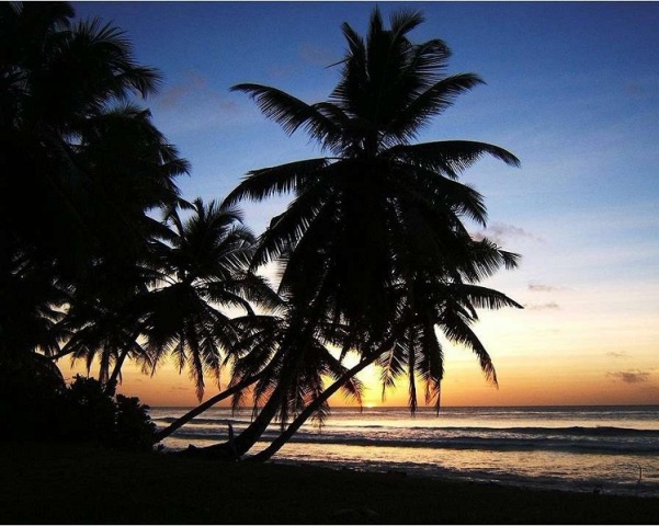
Diego Garcia, a British Indian Ocean Territory, is situated off the southern coast of India. Let us check out some fun and interesting facts about Diego Garcia.
Facts About Diego Garcia
Diego Garcia is the largest atoll in Chagos Archipelago, in terms of land area. It is located in the Indian Ocean, about 1,600 km (1,000 miles) to the south of the southern coast of India. A British Indian Ocean Territory, it now serves exclusively as a military reservation. Spread over 6720 acres, the atoll assumed the shape of a footprint on the ocean surface, when seen from air. This is the reason why Diego Garcia has been nicknamed as "Footprint of Freedom". Shallow reefs can be seen surrounding the island on the ocean side and also remain scattered inside the lagoon. The largest of the fifty two islands of Chagos Archipelago in terms of area, Diego Garcia is now the home to British and United States military personal and support personnel belonging to various nationalities. In case you want to know more about Diego Garcia, make use of the fun and interesting facts.

Image: By Blaine Steinert at en.wikipedia (Own work) [Public domain], via Wikimedia Commons
Fast Facts
Country: United Kingdom
Continent: Asia
Location: South of equator in the central Indian ocean
Population: 4000
Official Languages: English
Time zone: GMT + 06:00
Fun Facts about Diego Garcia
- Diego Garcia is an atoll located at 7°18′48″S 72°24′40″E, off the tip of India.
- Diego Garcia is the largest atoll in Chagos Archipelago, in terms of land area.
- The atoll is 3,650 km east of the coast of Africa, 1,790 km south-southwest of the southern tip of India and 4,720 km west-northwest of the west coast of Australia.
- Diego Garcia is a part of the British Indian Ocean Territory.
- Diego Garcia, as a part of Chagos archipelago, was leased to the United Kingdom in the 1960s.
- United Kingdom and United States entered an agreement in 1971, under which US set up a military base Diego Garcia.
- Since setting up a base in Diego Garcia, United States has enforced the controversial depopulation program.
- One of the five ground antennas that assist the operation of the Global Positioning System (GPS) has been set up in Diego Garcia.
- The island of Diego Garcia is spread over an area of 6,720 acres.
- The maximum elevation of Diego Garcia is 22 feet.
- The shape of Diego Garcia is that of a horseshoe and it has a perimeter of approximately 40 miles.
- Diego Garcia was initially an ancient volcano. However, it has now been reduced to an atoll, surrounding a central lagoon.
- Diego Garcia receives about 100 inches of rainfall every year.
- The island of Diego Garcia stretches for 15 miles, north to south, and about 35 miles from tip to tip of its horseshoe shape.
- The interior lagoon of Diego Garcia is 13 miles in length and 6.5 miles at its widest point.
- During the 19th century, the island of Diego Garcia was used for the purpose of plantations, producing copra and coconut oils.
- The island is believed to have been obtained its name from the Portuguese ship’s captain or navigator who found out the Island.
- After it was leased to United States in 70’s, it became the joined U.S-U.K military station during the cold war. Its location in the middle of Indian Ocean and out of the risk of cyclones increased its significance.
- Since 2006, around 1000 U.S military personnel, 40 British people and 2,400 support people from various nations stay here.
- The actual inhabitants of Diego Garcia namely Ilois, or the Chagossians were relocated to make the Island a U.S military base. With most of them including agricultural workers and fishermen, these inhabitants live in the Mauritius.
- You cannot find endemic species of plants, birds, amphibians, mollusks, reptiles, crustaceans and mammals on Diego Garcia in and around Diego Garcia. Instead you get to see several endemic fish and aquatic invertebrates.
Diego Garcia is a coral island located in Indian Ocean, under the British Territory which was leased to the United States as a military station. The island played a significant role in the cold war between United States and Soviet Union. Hope this article familiarizes you with this Island.
See also
More from iloveindia.com
- Home Remedies | Ayurveda | Vastu | Yoga | Feng Shui | Tattoos | Fitness | Garden | Nutrition | Parenting | Bikes | Cars | Baby Care | Indian Weddings | Festivals | Party ideas | Horoscope 2015 | Pets | Finance | Figures of Speech | Hotels in India : Delhi | Hyderabad | Chennai | Mumbai | Kolkata | Bangalore | Ahmedabad | Jaipur
- Contact Us Careers Disclaimer Privacy Policy Advertise With Us Lifestyle Sitemap Copyright iloveindia.com. All Rights Reserved.


